Where Data Tells the Story
© Voronoi 2026. All rights reserved.

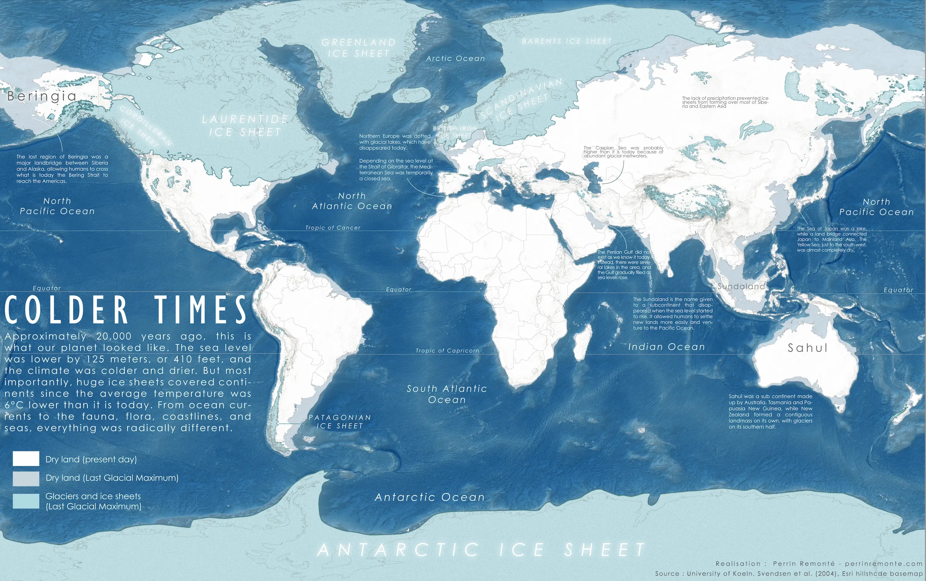
Back when ice sheets extended as south as New England, London and covered a large chunk of the Andes or New Zealand...
During the Last Glacial Maximum (LGM), that happened roughly 26,000 to 19,000 years ago, Earth saw lower sea levels, larger, drier landmasses, and a 6 °C temperature drop with climate conditions incredibly different from what we know and take for granted today.
Lower sea level exposed land bridges like Sundaland and the Bering Strait, forming a region known as 'Beringia' allowing humans to reach the Americas. Many other islands we know today were fully connected to continents, some seas didn't even exist. Landscapes were different too, mostly drier, but nonetheless featuring a diverse fauna, including megafauna like the famous woolly mammoth and many more big, furry mammals. Many of them have disappeared because of the natural global warming that occured since, but also because of human pressure, that allow humans to venture and settle farther north and south. The warming and rising sea level also made disappear many human settlements and places around the world, like the Doggerland, a region located between the UK and Belgium.